


Georgetown Voting District, Hanover County, Virginia
About
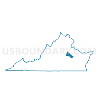
Outline

Summary
| Unique Area Identifier | 681829 |
| Name | Georgetown Voting District |
| County | Hanover County |
| State | Virginia |
| Area (square miles) | 20.31 |
| Land Area (square miles) | 20.05 |
| Water Area (square miles) | 0.25 |
| % of Land Area | 98.76 |
| % of Water Area | 1.24 |
| Latitude of the Internal Point | 37.71081980 |
| Longtitude of the Internal Point | -77.34474410 |
Maps


Graphs
Select a template below for downloading or customizing gragh for Georgetown Voting District, Hanover County, Virginia


Neighbors
Neighoring Voting District (by Name) Neighboring Voting District on the Map
- Ashcake Voting District, Hanover County, VA
- Atlee Voting District, Hanover County, VA
- Clay Voting District, Hanover County, VA
- Courthouse Voting District, Hanover County, VA
- Mangohick Voting District, King William County, VA
- Rural Point Voting District, Hanover County, VA
- Shady Grove Voting District, Hanover County, VA
- Studley Voting District, Hanover County, VA
Top 10 Neighboring County Subdivision (by Population) Neighboring County Subdivision on the Map
- Chickahominy district, Hanover County, VA (15,061)
- Henry district, Hanover County, VA (14,874)
- Ashland district, Hanover County, VA (13,251)
- Beaverdam district, Hanover County, VA (12,879)
- Mangohick district, King William County, VA (3,306)
Top 10 Neighboring Place (by Population) Neighboring Place on the Map
Top 10 Neighboring Unified School District (by Population) Neighboring Unified School District on the Map
Top 10 Neighboring State Legislative District Lower Chamber (by Population) Neighboring State Legislative District Lower Chamber on the Map
Top 10 Neighboring State Legislative District Upper Chamber (by Population) Neighboring State Legislative District Upper Chamber on the Map
Top 10 Neighboring 111th Congressional District (by Population) Neighboring 111th Congressional District on the Map
Top 10 Neighboring Census Tract (by Population) Neighboring Census Tract on the Map
- Census Tract 3209, Hanover County, VA (7,561)
- Census Tract 3210.02, Hanover County, VA (7,520)
- Census Tract 3208.03, Hanover County, VA (5,281)
- Census Tract 9501.01, King William County, VA (4,194)
- Census Tract 3207.02, Hanover County, VA (2,999)
- Census Tract 3207.01, Hanover County, VA (2,834)
- Census Tract 3214.01, Hanover County, VA (2,103)